Maps I’ve made
On this page you can see some of the maps that I’ve made. In order to enlarge or download them, please click or tap the image.
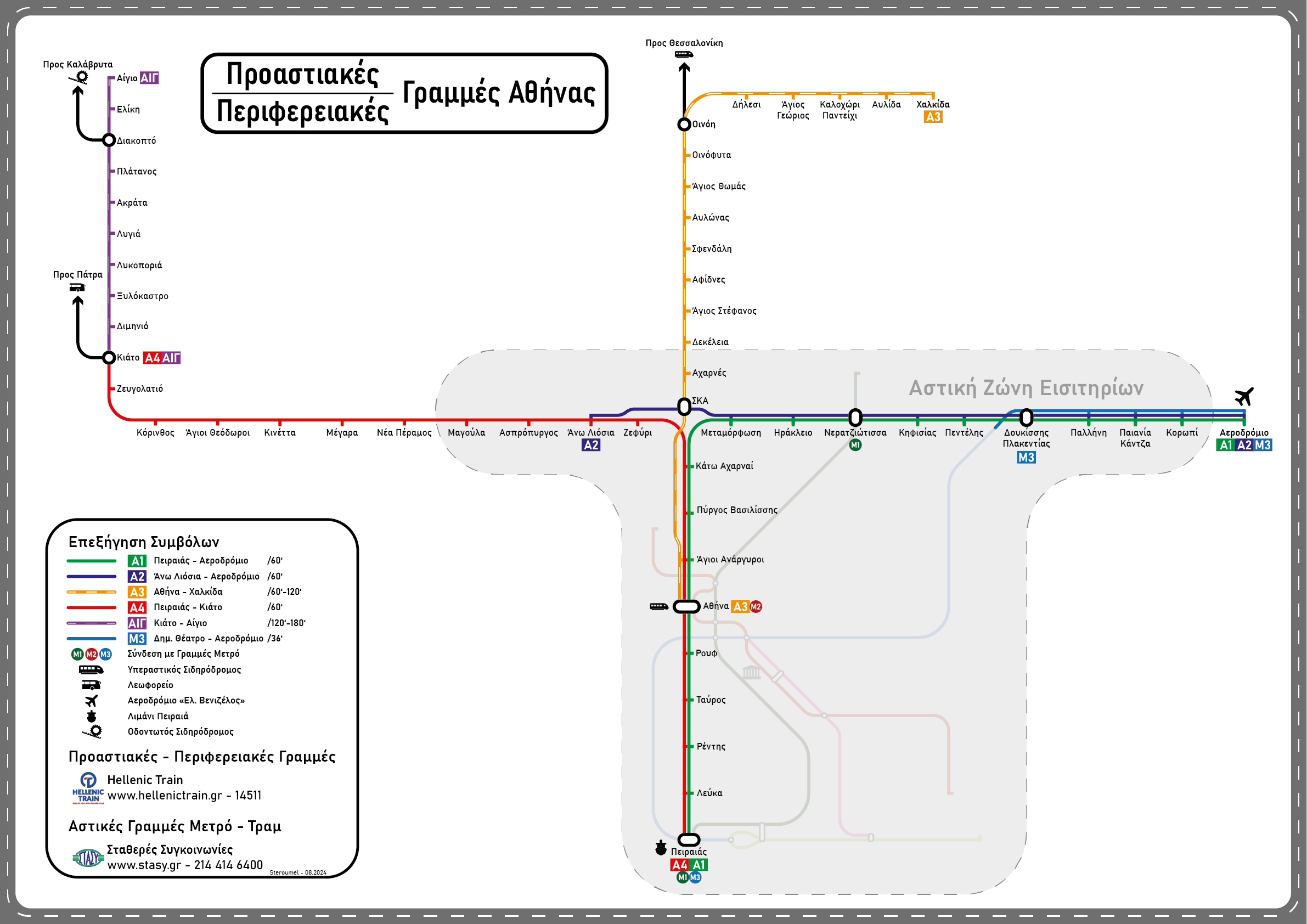
Athens Suburban Railway Map (2024)
A map of the suburban railway services around Athens. The metro services are also shown but without much detail.

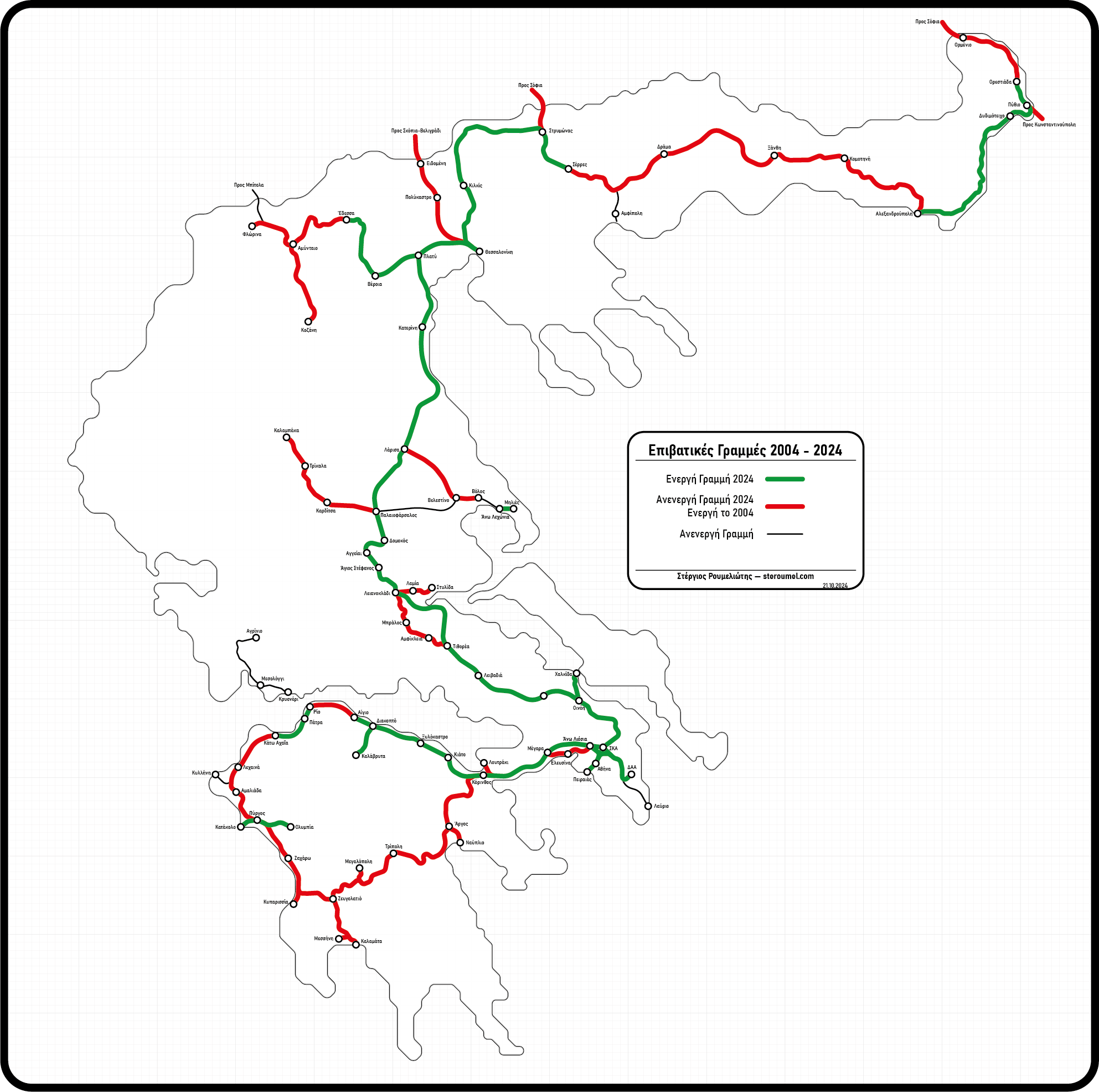
Passenger Service Map of Greece
Comparison between the passenger railway services during the Olympic Games of Athens (2004) and today (2024). Green is active today, red is not active today, although it was active in 2004. Black is for the lines that were already suspended before 2004.

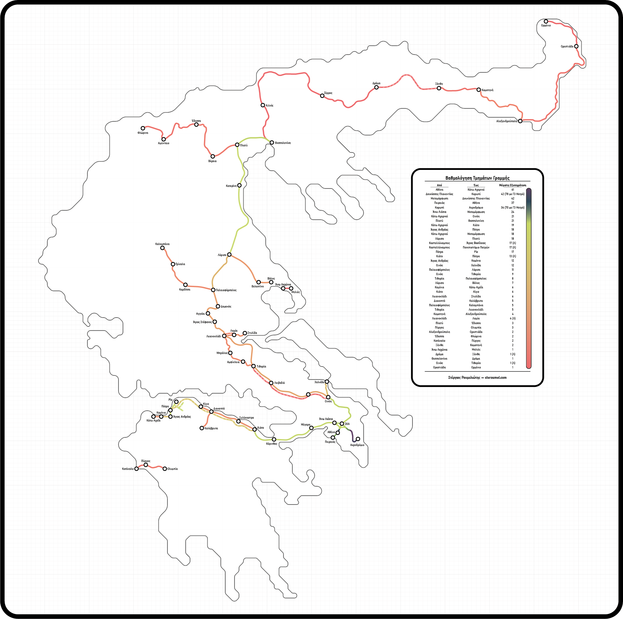
TrainOSE 2022 Services
This is a map projection of the entire timetable of the contract between the Greek state and TrainOSE (member of the FSI).

Central Greece Railway Services Maps (2021)
I made these maps in April 2021, as there is no available map of this area. They are divided in two, covering all the stations of Central Greece that are served by Regional and Intercity trains, but not the ones served by Athens’ Suburban Rail.


Athens Suburban Railway Map (2021)
I made this map in March 2021, as any other available map is outdated and I didn’t really like their designs.

Patras Suburban Rail Map (2020)
I made this map with Maria Barmpagianni in early 2020, as there was no official map for the services. The map is updated as of 17.05.2021 to include all stops for both the north and the south branch and all the Ticket Zones.

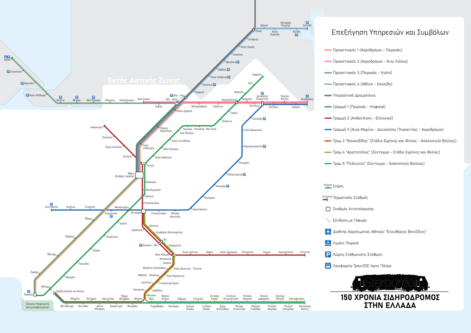
Athens Rail Map (2018)
I made this map back in 2018, as there’s no official map containing metro and suburban lines and trams.
